| Historical Georgia 1777 Parish Map | A Map of 1777 Georgia |
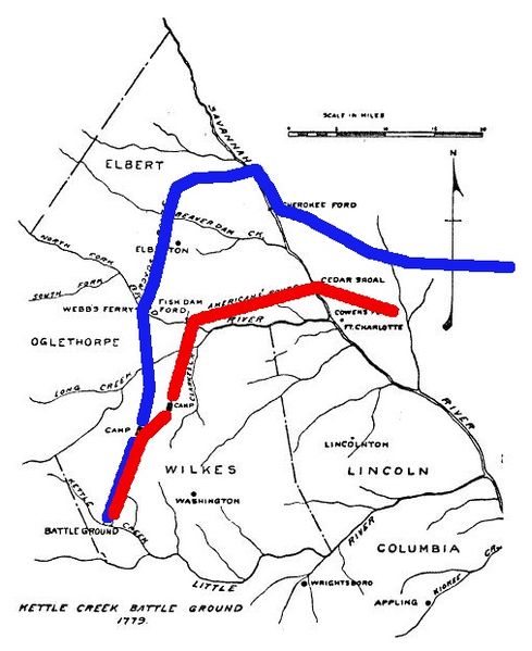
| Historical Georgia 1779 | A Map of 1779 Georgia Battle of Kettle Creek |
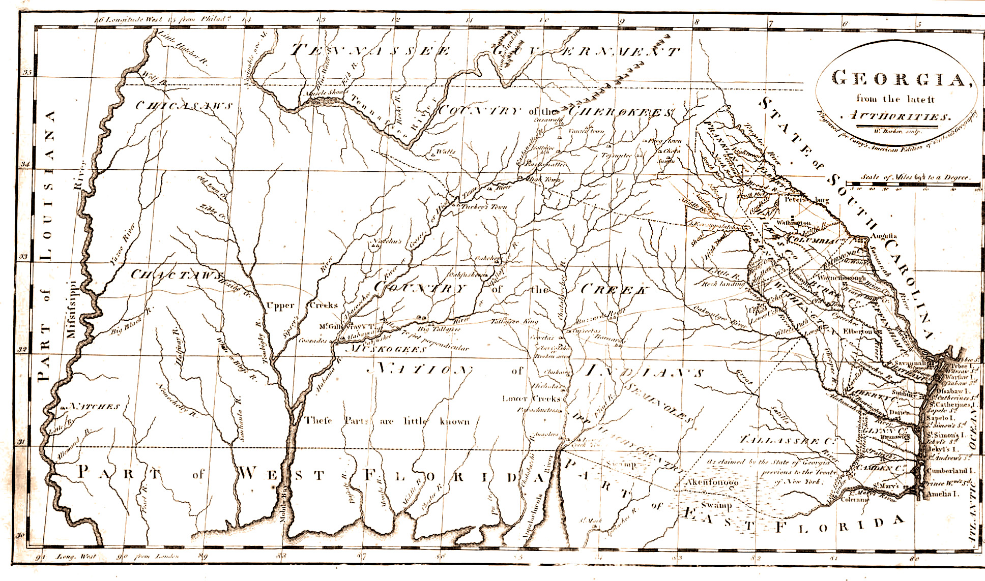
| Historical Georgia 1794 | A Map of 1794 Georgia |
| Historical Georgia 1795 | A Map of 1795 Georgia |
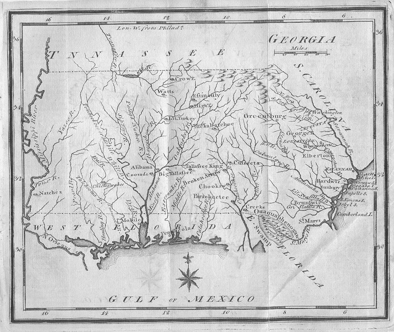
| Historical Georgia 1796 | A Map of 1796 Georgia |
| Historical Georgia 1797 | A Map of 1797 Georgia |
| Historical Georgia 1801 | A Map of 1801 Georgia |
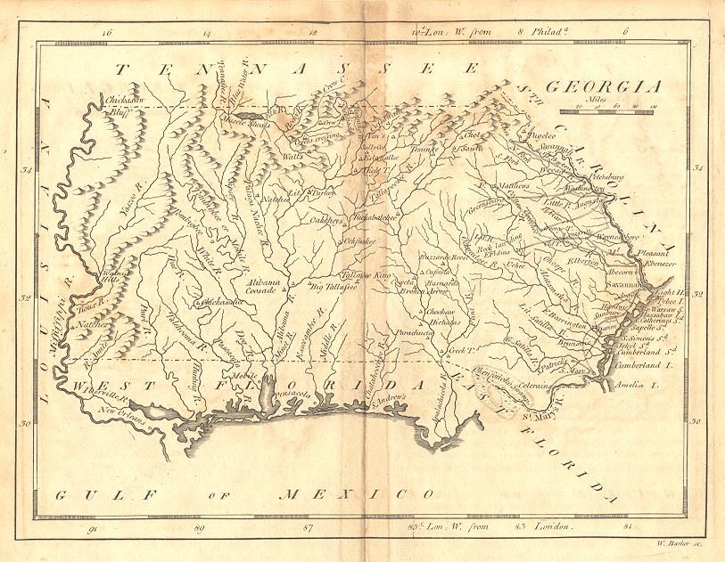
| Historical Georgia 1805 | A Map of 1805 Georgia |
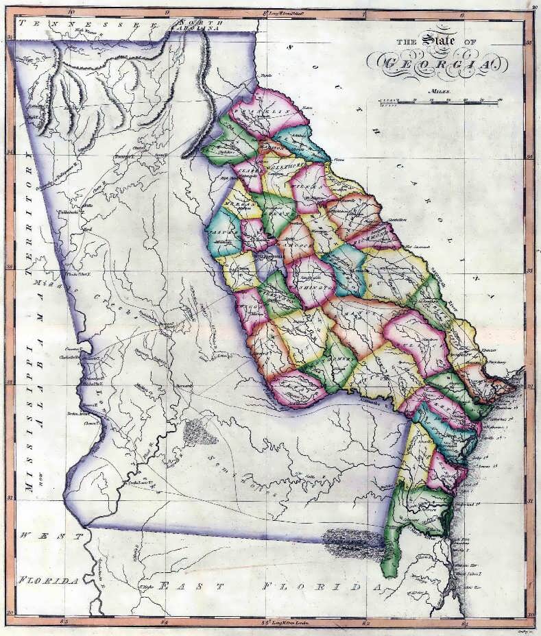
| Historical Georgia 1819 | A Map of 1819 Georgia |
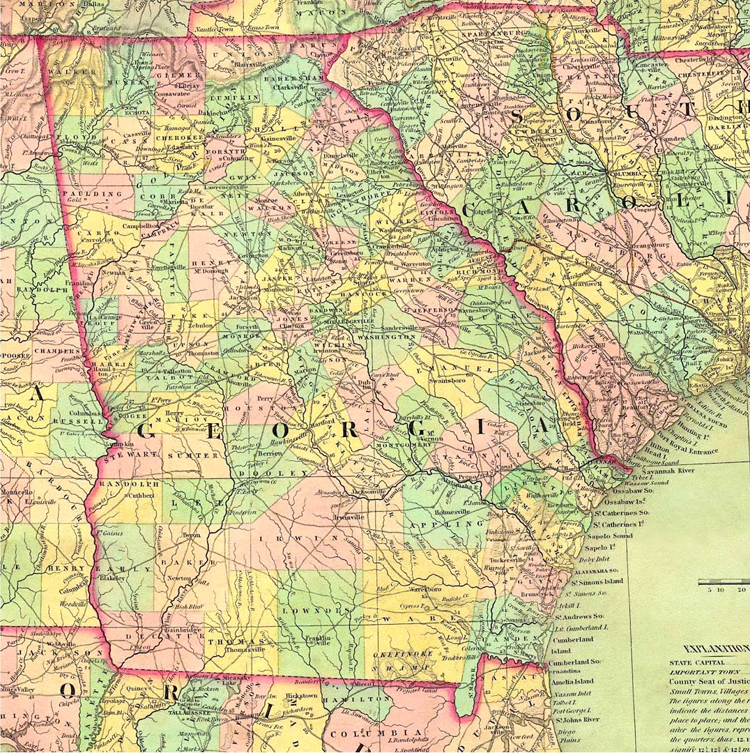
| Historical Georgia 1822 | A Map of 1822 Georgia |
| Historical Georgia 1830 | A Map of 1830 Georgia |
| Historical Georgia 1834 | A Map of 1834 Georgia |
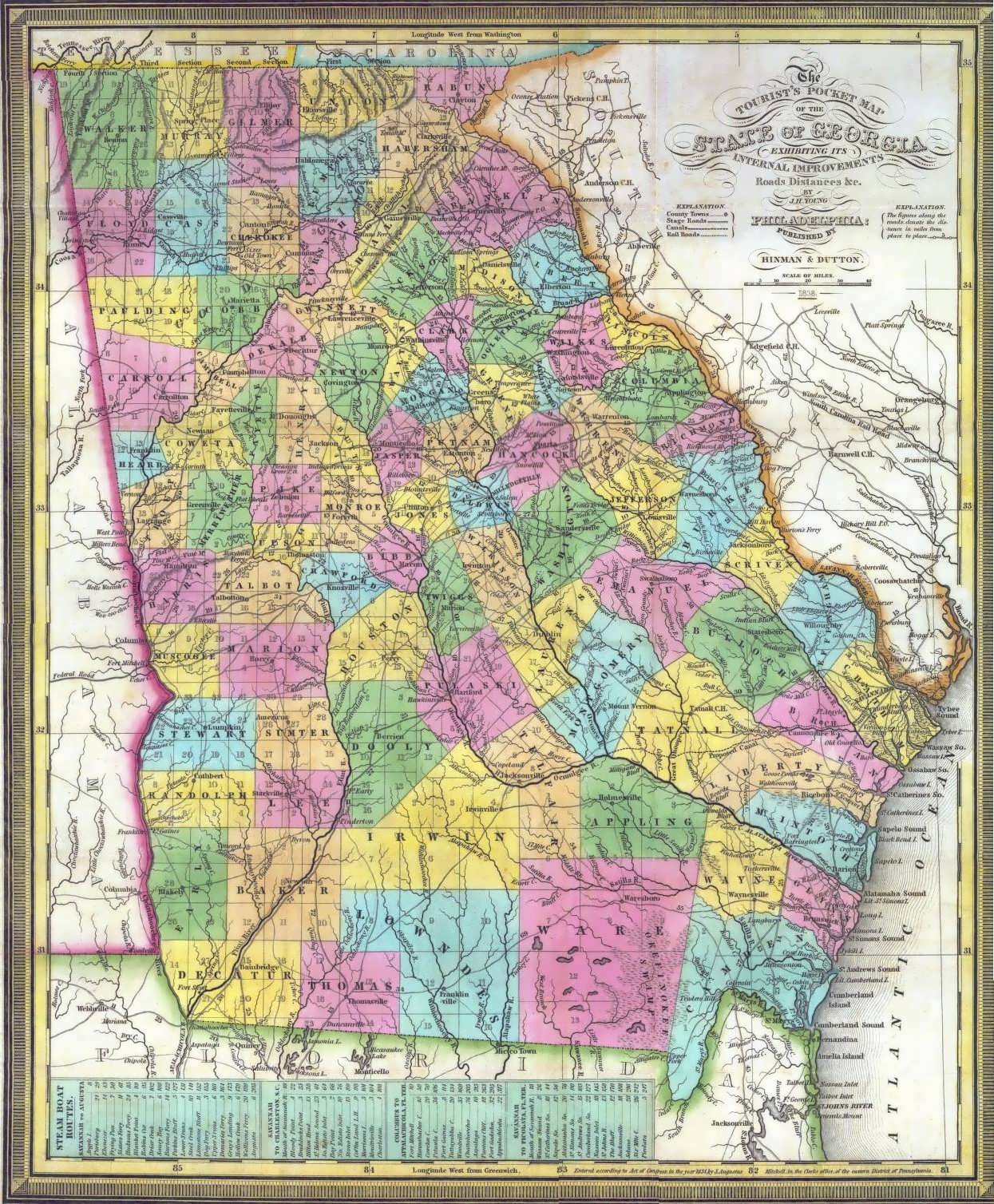
| Historical Georgia 1839 | A Map of 1839 Georgia |
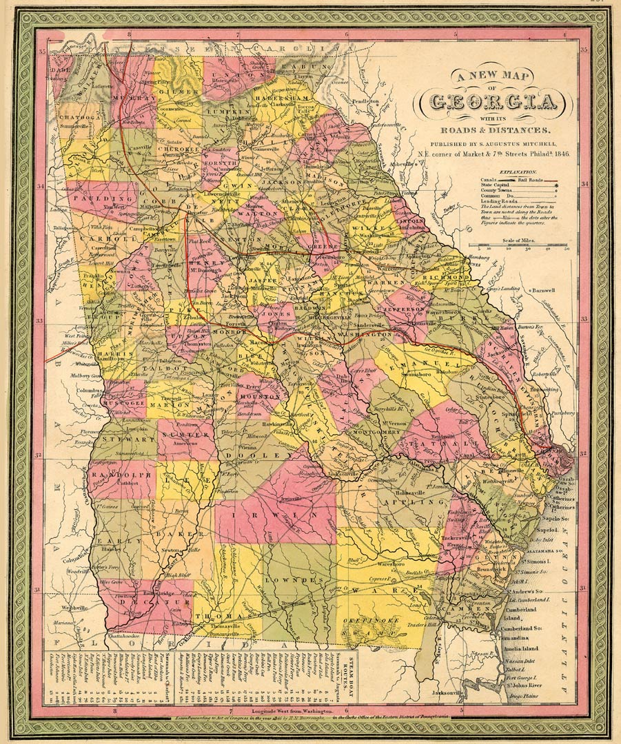
| Historical Georgia 1846 | A Map of 1846 Georgia |
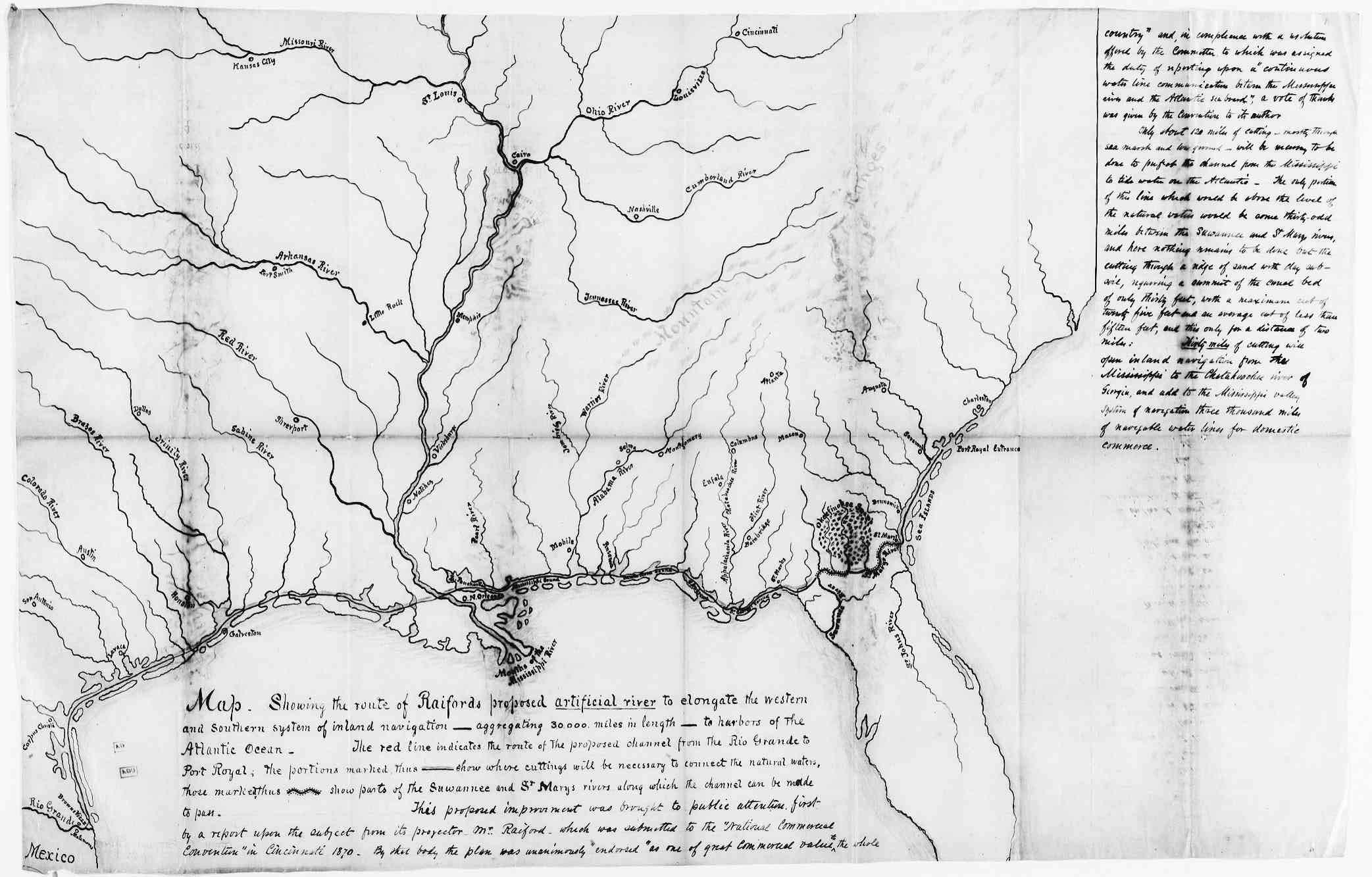
| Historical Georgia 1870 | A Map of 1870 Georgia River Routes |
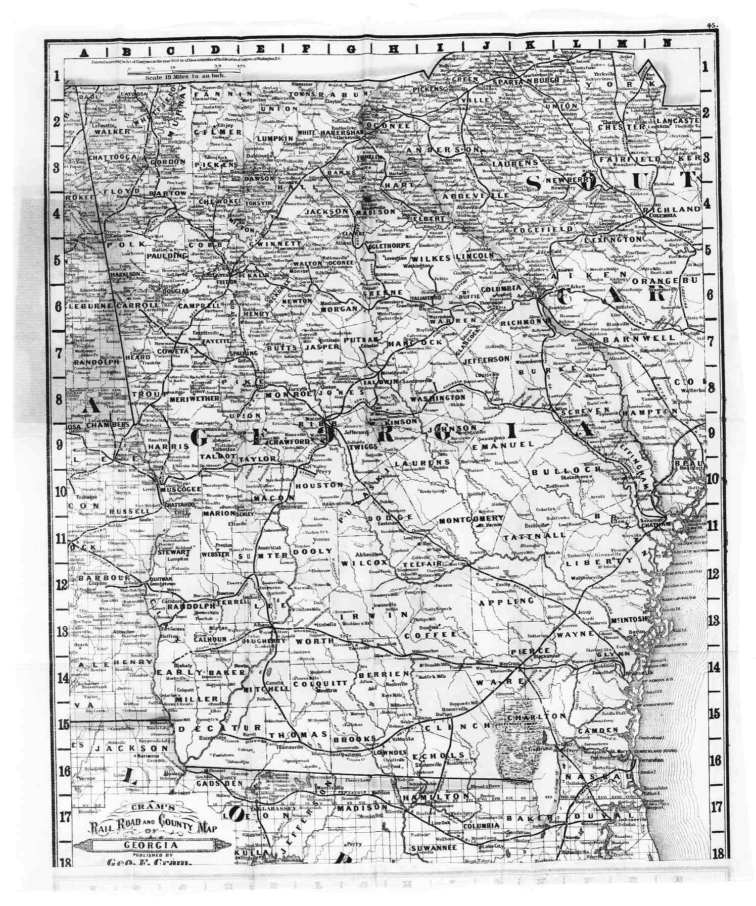
| Historical Georgia 1881 | A Map of 1881 Georgia Railroad and County Map |
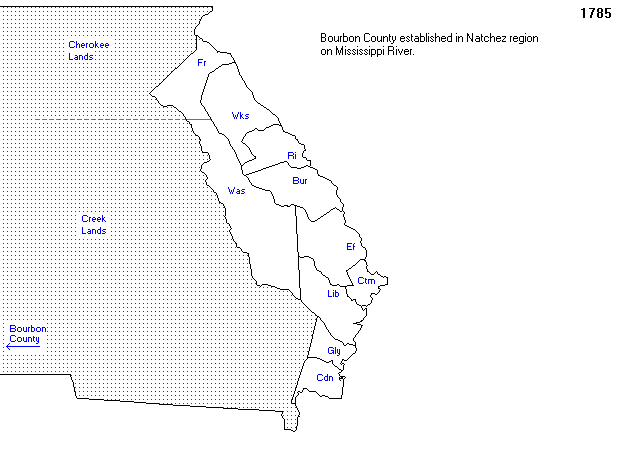
| County Formation 1785 | A Map of 1785 Georgia Counties |
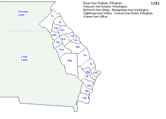
| County Formation 1793 | A Map of 1793 Georgia Counties |
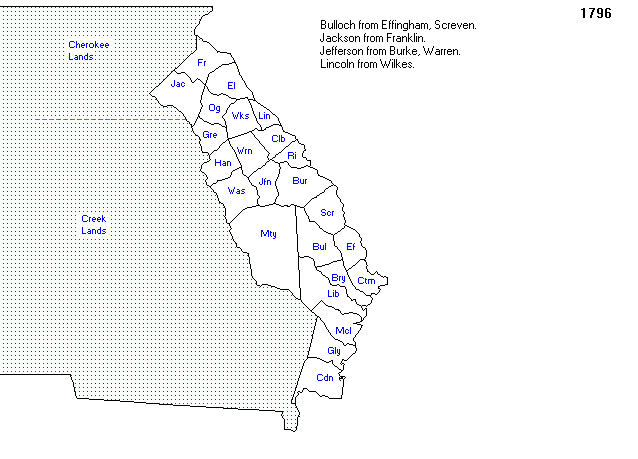
| County Formation 1796 | A Map of 1796 Georgia Counties |
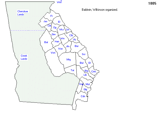
| County Formation 1805 | A Map of 1805 Georgia Counties |
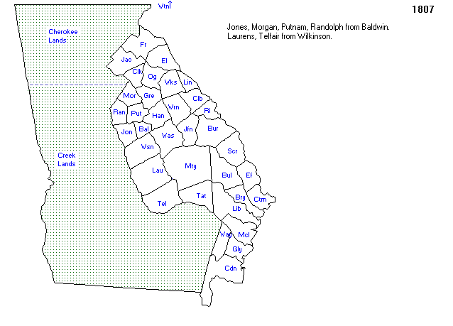
| County Formation 1807 | A Map of 1807 Georgia Counties |
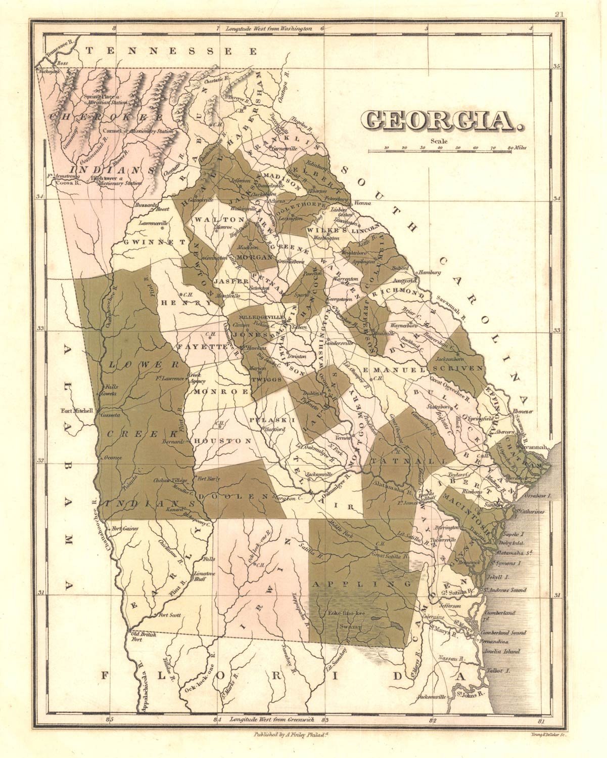
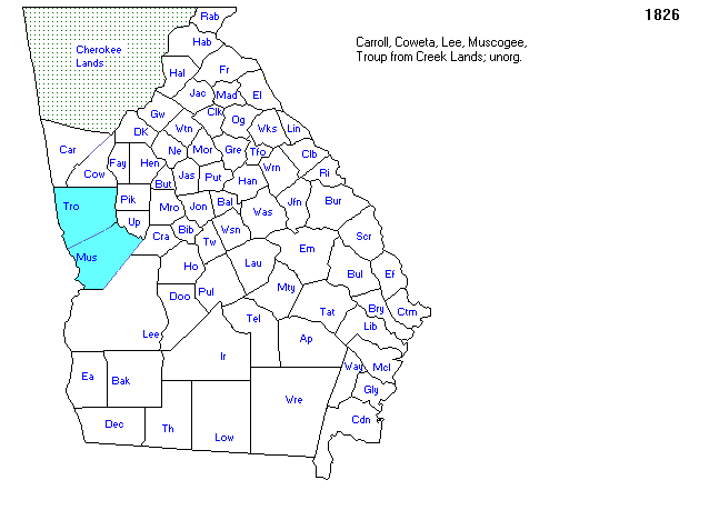
| County Formation 1826 | A Map of 1826 Georgia Counties |
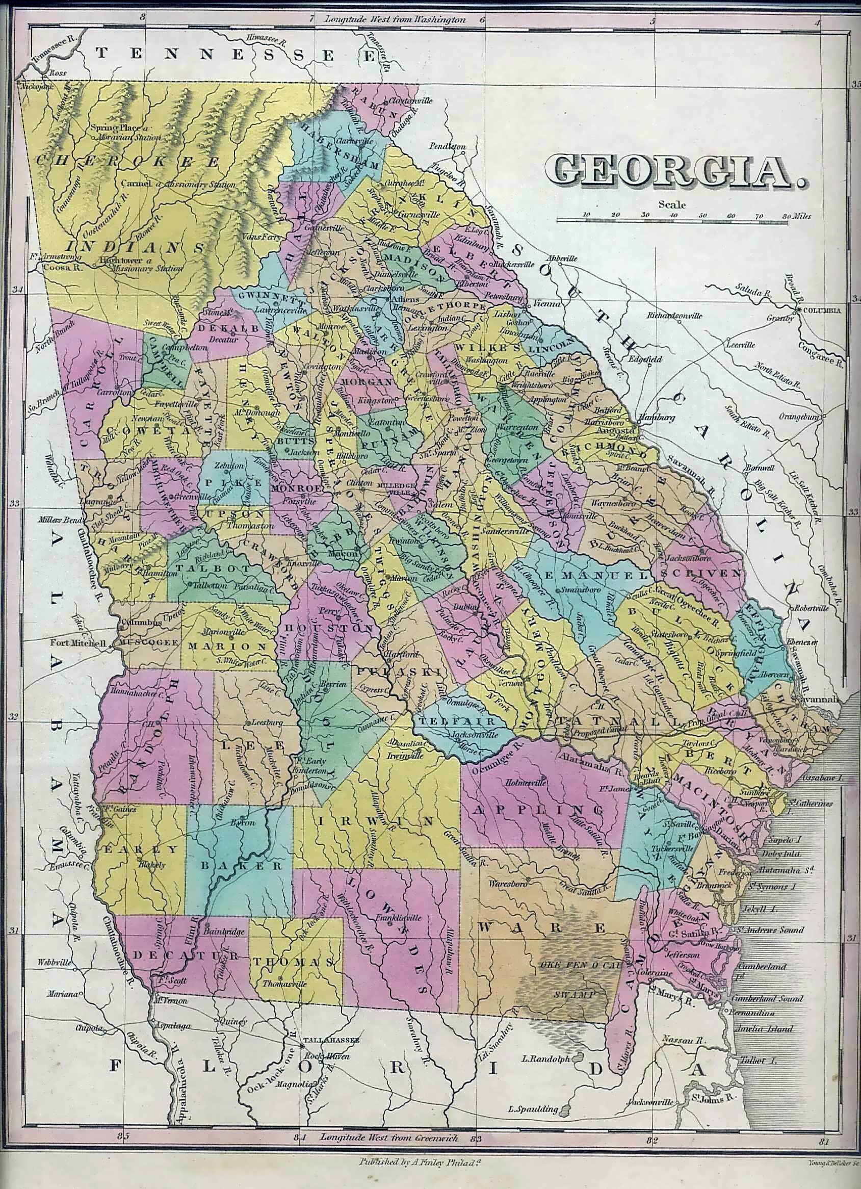
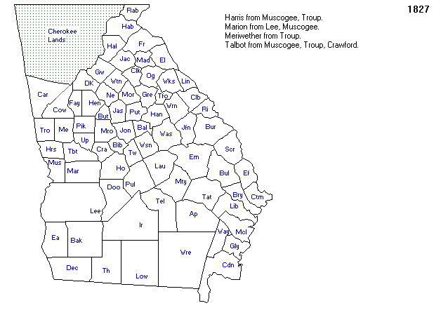
| County Formation 1827 | A Map of 1827 Georgia Counties |
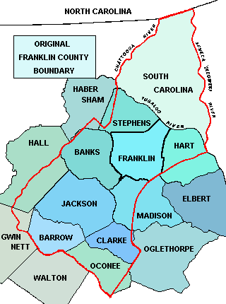
| County Formation Original Franklin County | A Map of Original Franklin Georgia County |
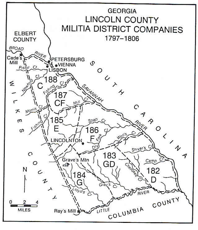
| County Formation Original Lincoln County | A Map of Original Lincoln Georgia County |
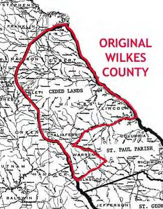
| County Formation Original Wilkes County 1 | A Map of Original Wilkes Georgia County 1 |
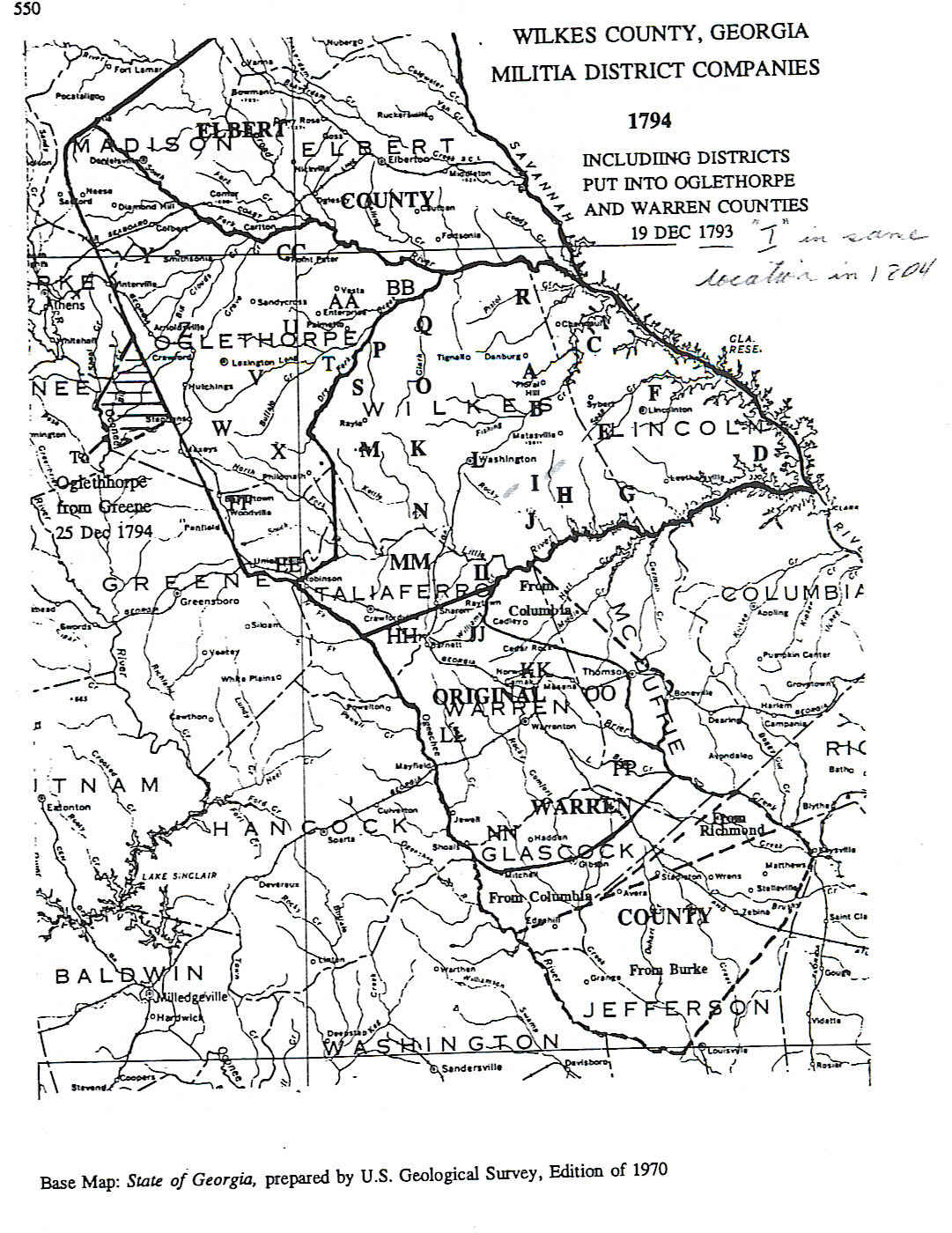
| County Formation Original Wilkes County 2 | A Map of Original Wilkes Georgia County 2 |
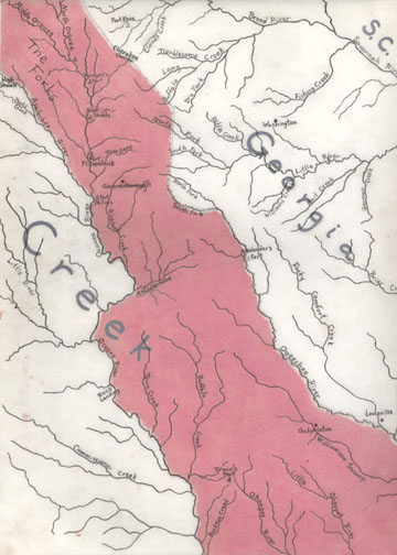
| County Formation Occonnee War Map | A Map of the Occonnee War |
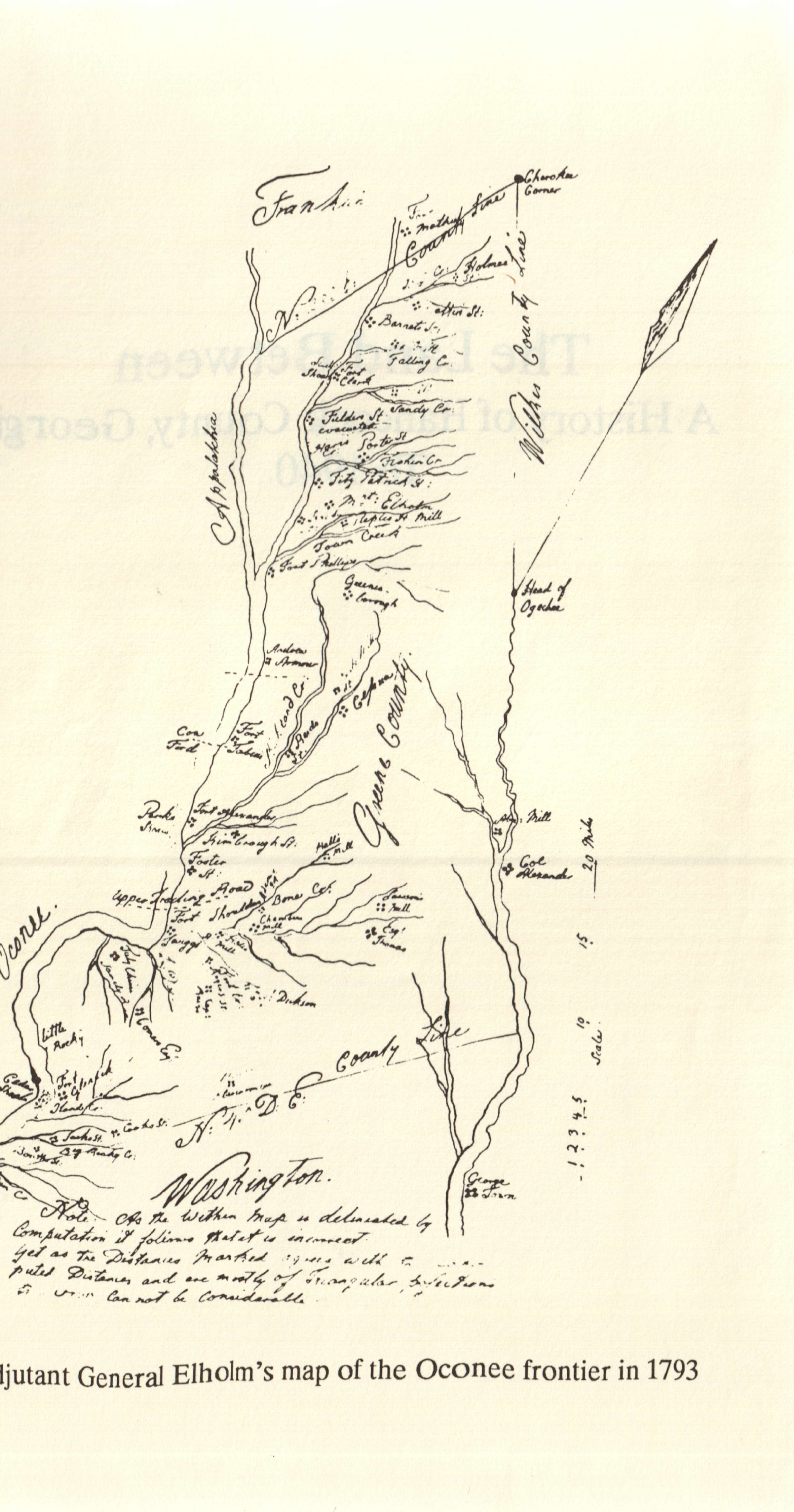
| County Formation Occonnee Frontier 1793 | A Map of 1793 Occonnee Frontier |
| Jones County Land Lots | Land Lots located in District 10 of Jones County |
| Jones County Militia Districts | Jones County Militia Districts |
| 1998 Jones County Tax Map 1 | 1998 Tax Map showing location of Kirk Family Lands |
| 1998 Jones County Tax Map 2 | 1998 Tax Map showing location of Hunt, Hungerford and Cabaniss Lands |
| 1998 Jones County GMD Map | 1998 GMD Map showing location of Kirk Lands |
| Hancock County 1794 Tax Digest Watercourses | 1794 Kirk and Womack Watercourses |
| Wilkes County Original | 1777 Map of the Original Wilkes County - an overlay |
| 1794 Wilkes GMD | 1794 Map of the Wilkes County Milita Districts |
| Georgia River Basins | A map of Georgia River Basins |
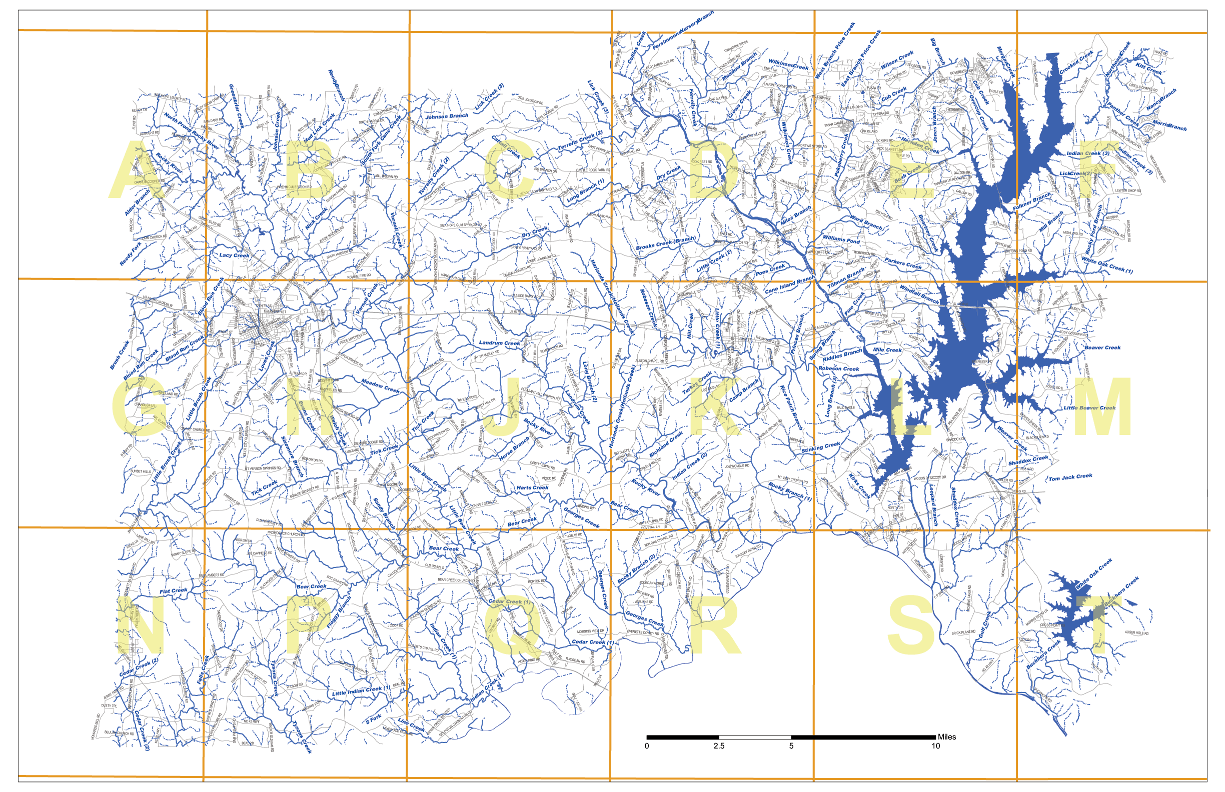
| Georgia Watersheds | A KAB Affiliates detailed map of Georgia Watersheds |
| The Ogeechee River | A map of the Ogeechee River |
| DOT map County Baldwin | Baldwin |
| DOT map County Columbia | Columbia |
| DOT map County Glascock | Glascock |
| DOT map County Greene | Greene |
| DOT map County Hancock | Hancock |
| DOT map County Jasper | Jasper |
| DOT map County Jefferson | Jefferson |
| DOT map County Jones | Jones |
| DOT map County Lincoln | Lincoln |
| DOT map County Oglethorpe | Oglethorpe |
| DOT map County Putnam | Putnam |
| DOT map County Richmond | Richmond |
| DOT map County Taliaferro | Taliaferro |
| DOT map County Warren | Warren |
| DOT map County Washington | Washington |
| DOT map County Wilkes | Wilkes |
North Carolina Maps
| Jordan Lake State Recreation Map | A visitors guide for camping and recreation on Jordan Lake |
| Chatham County Rivers | A detailed guide of rivers, creeks and bridges in Chatham County |
| Chatham County Creek List | A list of Creeks and their names located in Chatham County |
| Chatham County Creeks | A detailed map of creeks in Chatham County |
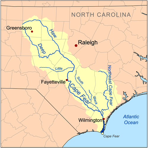
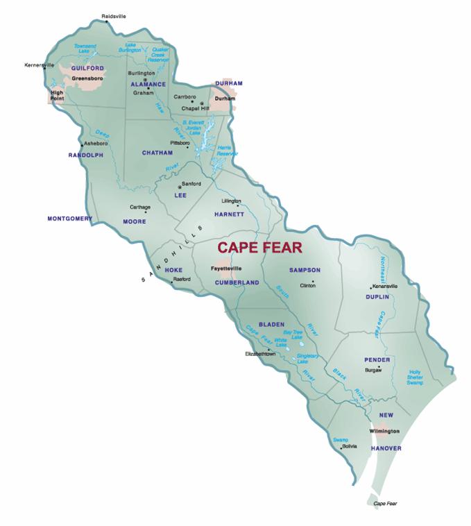
| Cape Fear Overview | A map of the Cape Fear River Region |
| Cape Fear River Basin | A map of the Cape Fear River Basin and location relative to Counties |
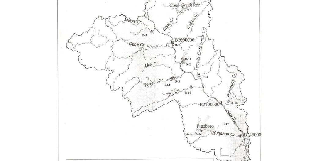
| Northern Haw River Creeks | A map of creeks on the Northern Portion of Haw River |
United States Historical Maps
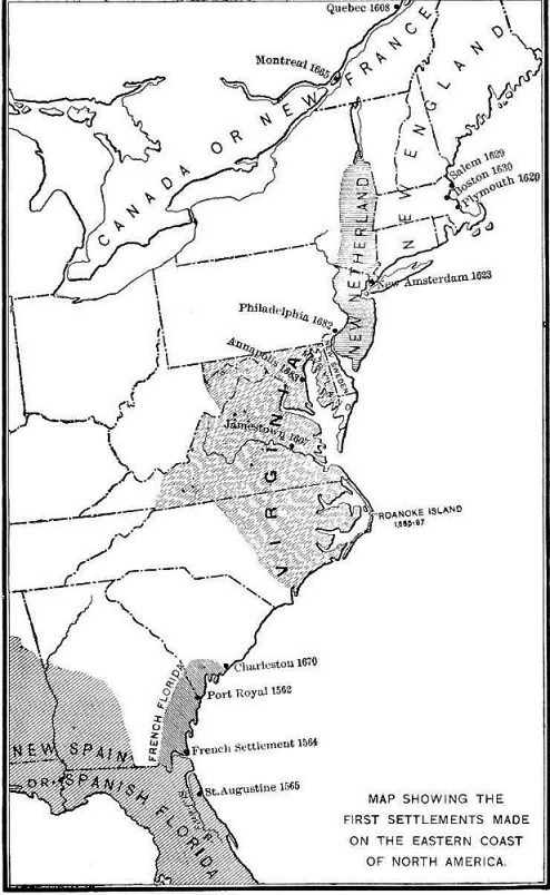
| 1600 Settlements | 1600 Colonial Settlements |
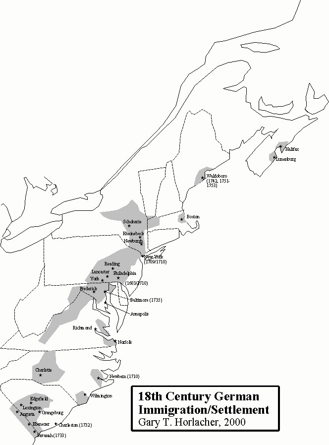
| 1700 Colonial Settlements | 1700 German American Settlements |
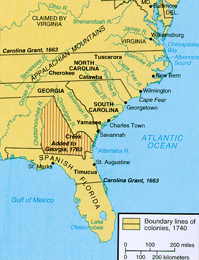
| 1740 Colonial Boundary Lines | 1740 Boundary Lines of the Colonies |
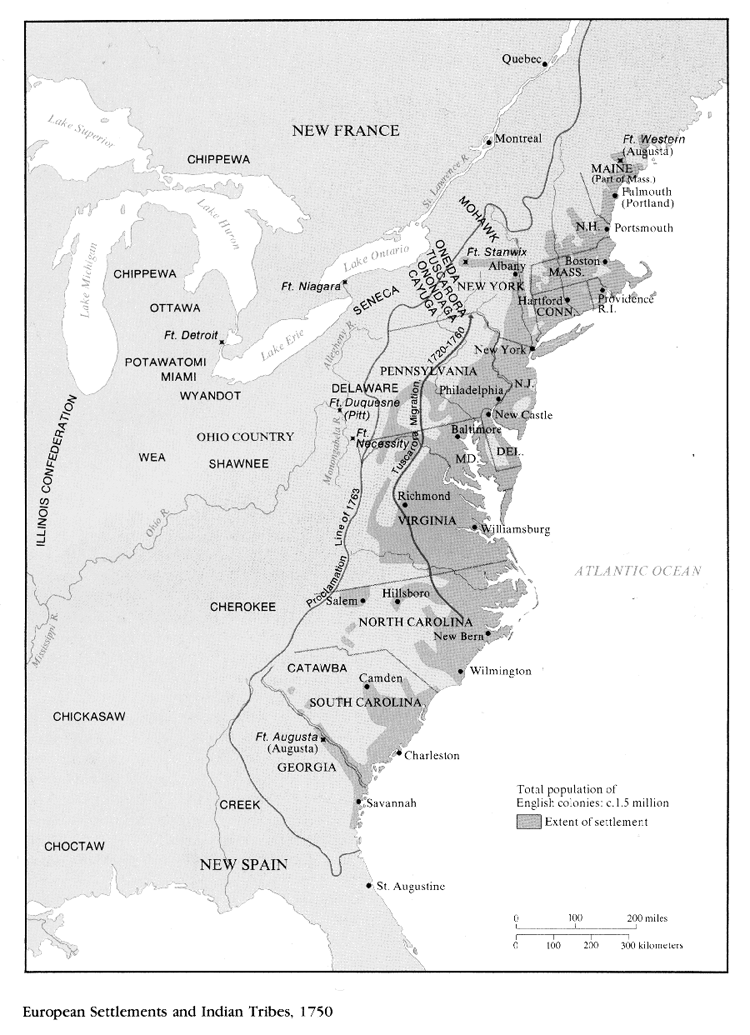
| 1750 Native American Tribes | 1750 Native American Tribes |
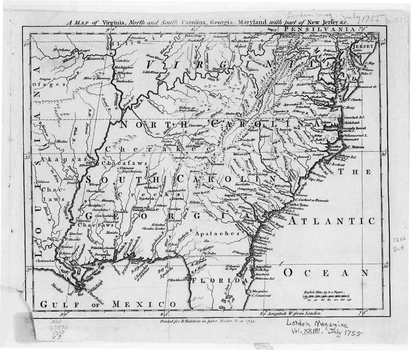
| 1755 Carolina's | 1755 Carolina's |
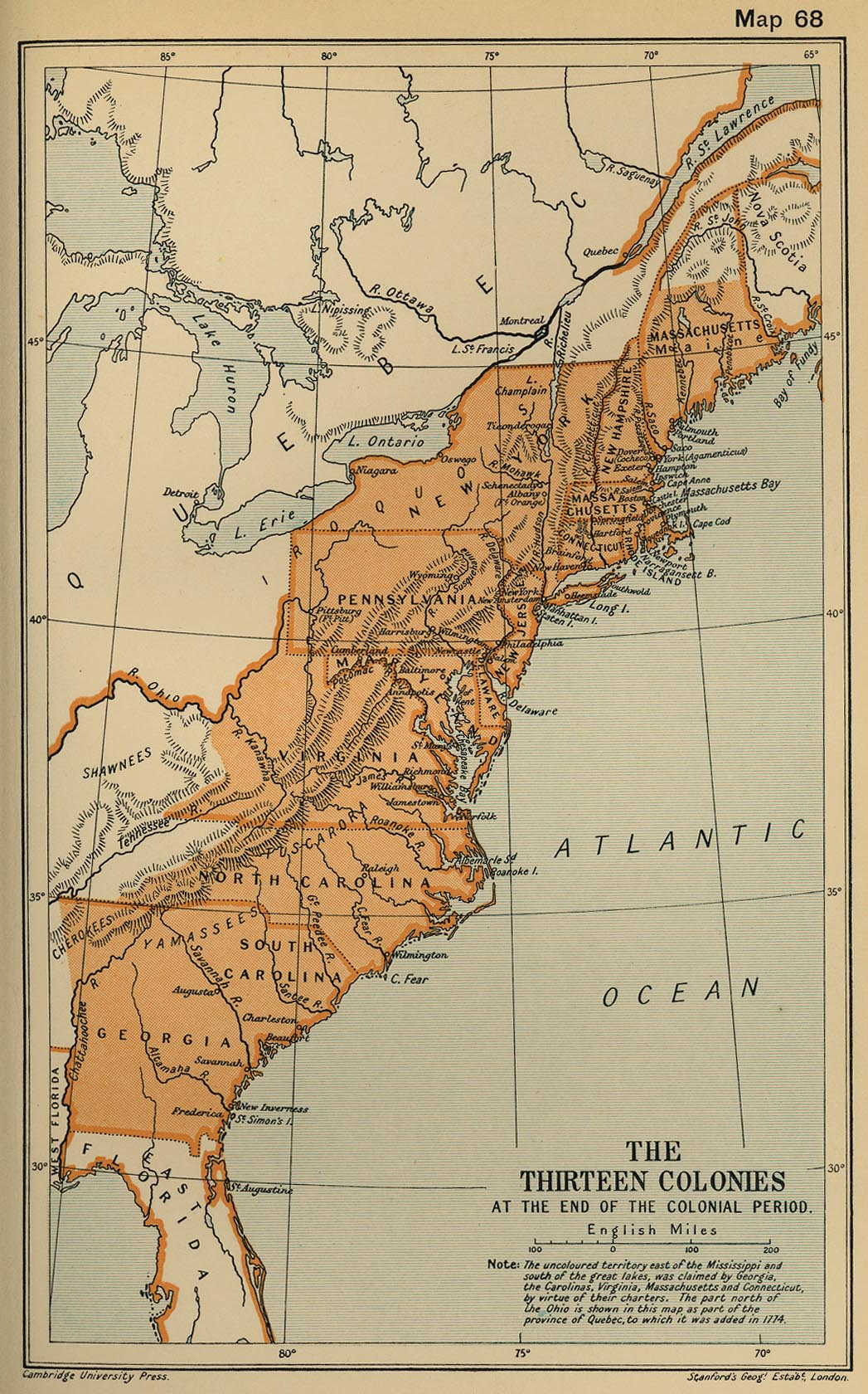
| 1775 American Colonies | 1775 American Colonies |